The phrase turns up without warning. It is printed on a plat, buried in a legal description, listed on a title commitment, or drawn as a dashed line across a county road map for the parcel you are about to buy. Nothing about it tells you whether right of ways are a rule you follow, a permission somebody else holds, or a piece of your land that is no longer entirely yours.
There is a driving meaning of the term, the one about who yields at a four-way stop. Merriam-Webster carries it as sense 3a, "a precedence in passing accorded to one vehicle over another by custom, decision, or statute," and the entry lists it last. If that is what you came for, your state's traffic code is the place to look, and this is not the page.
The rest of this is about the property sense, the strip of ground.
We read the six pages currently ranking for this phrase, roughly 6,010 words between them. Every one describes a right of way as a right or a permission. Across all six there are zero statutes quoted, zero cases cited, zero counties named, and exactly one number.
Three independent authorities disagree with all six. A federal regulation, a state legislature, and the dictionary all define the term as land.
That reframing turns four vague worries into answerable questions. How wide is the strip, who owns the dirt under it, who maintains it, and what you may put in it. The ranking pages answer none of them with a number. This article answers all four with citations you can go read yourself.
One county code publishes the right of way width and the road surface width in consecutive subsections, and the two numbers are not the same. The gap between them is land you own and cannot freely use.
Rights of Way, Right of Ways, or Right-of-Way: Which One Is Correct
If you searched "right of ways" and wondered whether you had it wrong, you did not.
Merriam-Webster hyphenates the headword as right-of-way, and its inflection line reads "plural rights-of-way also right-of-ways". In Merriam-Webster's conventions, "also" marks a variant that is less common but still standard, not a mistake. Rights-of-way is the primary plural. Right-of-ways is an accepted second one.
That entry does not list the unhyphenated spellings as inflected forms, so we are not going to tell you the dictionary blesses the spaced-out versions. What it shows is that the term is hyphenated and that both plurals are fine in hyphenated form. The spaced-out spellings are simply what most people type.
More useful is what the bodies that draft this material actually do. Nevada's statutes write "rights-of-way" at NRS 405.191. The federal regulation at 43 CFR 2801.5 uses right-of-way and rights-of-way. Mohave County, Arizona writes "rights-of-way" in its minor land division regulations.
So when you search your county's land use code, its GIS layer names, or the recorder's index, search the hyphenated form too. The drafters used hyphens, and searching only the three-word version can miss them. Nobody at the recorder's counter will care which one you say out loud.
Those same three bodies also define the term in a way that contradicts nearly everything else written about it.
What a Right of Way Actually Means: Land, Not Permission
The federal agency that issues rights of way across public land does not use the word to mean permission. It uses a different word for that.
43 CFR 2801.5 is the definitions section for the Bureau of Land Management's right-of-way program.
"Right-of-way means the public lands that the BLM authorizes a holder to use or occupy under a particular grant or lease."
The public lands. Not the authorization. The same section defines Grant separately as the instrument the BLM issues under Title V of the Federal Land Policy and Management Act, naming three possibilities, an easement, a license, or a permit. In federal regulation the grant is the permission and the right-of-way is the dirt.
Nevada's legislature landed in the same place. NRS 365.534 reads,
"Right-of-way means: 1. Any public road, highway, street or alley. 2. Any real property or any interest therein that is acquired, dedicated or reserved for the construction, operation and maintenance of a public road, highway, street or alley."
Real property. That definition sits in Chapter 365, Nevada's motor vehicle fuel tax chapter, and governs the sections referencing it, so it is not Nevada's universal definition for every purpose. It is still what the Legislature wrote down when it sat down to write one, and it wrote land.
Then the dictionary, where the shape of the entry is the argument. Sense 1 is the permission, "a legal right of passage over another person's ground." Senses 2a through 2d are all land, including 2b, "the strip of land over which is built a public road." Sense 3, the one we set aside, is listed last. Four land senses to one permission sense.
Select ROW, a right-of-way acquisition firm, writes that an easement in gross "become[s] revocable if property ownership changes." Rocket Mortgage writes that an easement in gross applies "regardless of who owns the land." Both rank for this term, they say opposite things, and neither cites a source.
We are not going to pick between them. 43 CFR 2801.5 does establish that a right of way can ride on an easement, a license, or a permit, and those three do not have the same staying power. Which one you have is written in your recorded instrument.
How Wide Is a Right of Way? 60 Feet of Strip for a 40 Foot Road
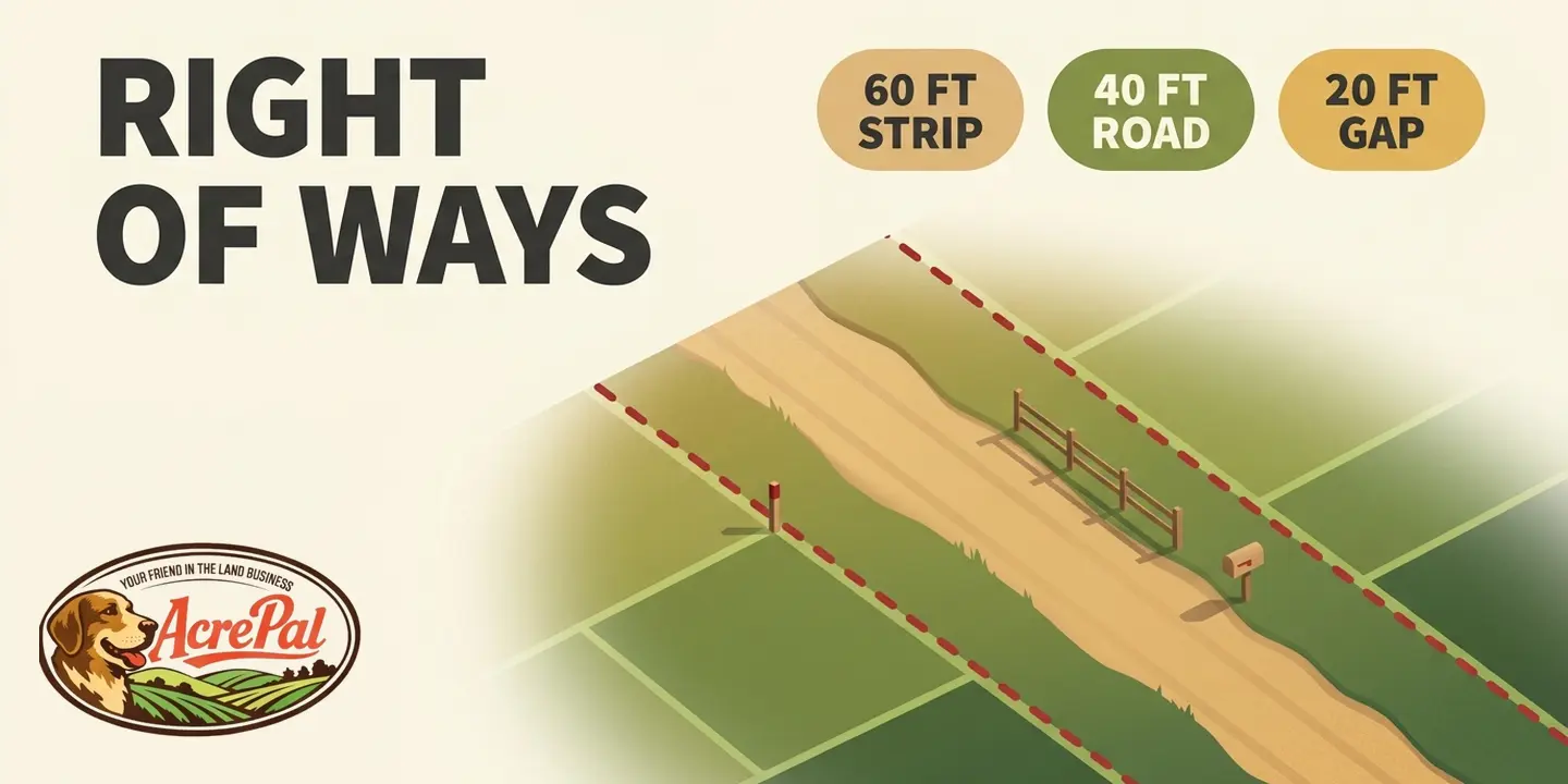
In Costilla County, Colorado, the right of way for a County Road is 60 feet wide. The road surface inside it is 40 feet. Roughly ten feet on each side is still right of way, and that is exactly where people put things.
The county publishes both numbers in consecutive subsections of its Land Use Code. Section 12.30 L, on page 81, is titled Rights-of-Way Width and states that "Street and road rights-of-way shall conform to the following minimum right-of-way widths, except as provided for in M. below." Section 12.30 M, on page 82, covers Minimum Road Width, meaning "Street and road roadway surfacing widths, as measured from shoulder edge to shoulder edge or curb to curb."
| Road class | Right-of-way width (12.30 L) | Road surface width (12.30 M) | Difference |
|---|---|---|---|
| County Road | 60 feet | 40 feet | 20 feet |
| Residential Arterial | 60 feet | 40 feet | 20 feet |
| Residential Collector | 60 feet | 32 feet | 28 feet |
| Residential Local | 50 feet | 30 feet | 20 feet |
| Frontage Road | 30 feet | 30 feet | 0 feet |
| Alleys | 12 feet | 12 feet | 0 feet |
The Residential Collector row is the widest gap at 28 feet. That extra width carries shoulders, drainage, buried utility lines, and room to swing a grader. It is also where fences, gates, mailboxes, culverts and sheds end up.
Read those figures for what they are. They are minimums under Costilla County's Land Use Code, and subsection L is expressly qualified "except as provided for in M. below." They are not the width of every existing road in the county, and an older road may predate the code.
Mohave County, Arizona's Minor Land Division Regulations, at Section 7.C.5.b, require that easements granted or rights of way dedicated for legal access "shall be twenty-four (24) feet in width, whether located entirely on one property or split between adjoining properties." That is Mohave County's minor land division standard, not a universal county road width and not a statewide figure.
Florida sets the width a third way. Under Fla. Stat. 95.361(1), a road maintained or repaired continuously for four years by a county, a municipality or the Department of Transportation is deemed dedicated to the public "to the extent in width that has been actually maintained for the prescribed period, whether or not the road has been formally established as a public highway." The legal width is set by where the grader and the mower went.
One number appears in the entire ranking set. Gateway Fiber, an internet provider, writes that "Easements may reach 35 feet wide depending on local jurisdiction. They're typically split evenly between adjacent properties." Thirty-five feet may well be correct somewhere. With no jurisdiction attached it cannot tell you anything about your parcel, and the twelve figures above can, each with a county and a section number.
Full disclosure on why the examples come from these counties. We sell land in Costilla County and in Mohave County, so those are the codes we have read most closely. Your county publishes its own version of the same tables and they are public records. Widths like these are usually set when the land is platted, which we walk through in our post on how to subdivide a property.
Who Owns Right of Way Property, and What Happens If the Road Goes Away
Most people assume the strip belongs to the county, or to the power company, or to whoever built the road. The counties themselves say otherwise.
Mohave County's Zoning Ordinance defines Easement as "That portion of a lot or lots reserved for present or future use by a person, utility, or agency other than the legal fee owner(s) of the property. The easement may be for use under, on or above said lot or lots and may be public or private." There is still a legal fee owner, and on your parcel that is you.
The same ordinance defines Easement, Ingress & Egress as "An easement granting public access through privately owned lot or lots via a specified width." Privately owned. And a specified width, one more public body describing a right of way as a measured thing.
So when people ask who owns right-of-way property, the answer is that you hold fee title to the ground and somebody else holds a defined right to use part of it. Acres.com, one of the ranking pages, publishes a types table with an "Owned By" column assigning ownership to the government or the utility, then contradicts it in its own body text on the same page.
What happens if the road goes away is the better question, and Costilla County answers it in writing. Its Land Use Code, under Recordation and Vesting of Title, provides that "Upon vacation of a roadway or right-of-way associated with a roadway, title to the lands included within such roadway or associated right-of-way, or so much thereof as may be vacated, shall vest subject to the same encumbrances, liens, limitations, and restrictions as the land to which it accrues." Where a roadway bounded by straight lines is vacated, that title vests "in the owners of the abutting land, each abutting owner taking to the center of the roadway."
The strip does not become nobody's land and it does not stay the county's. It splits down the middle.
Vacation is not automatic, though. Costilla's Board has to find nine separate conditions first, including that "The roadway, right-of-way or easement proposed to be vacated is no longer needed for the purpose for which it was dedicated, and the proposed vacation would be in the best interest of the residents of Costilla County." That centerline rule is Costilla County's own code, not general law, and your county may split it differently or not at all. Four of the six ranking pages do discuss removing or terminating an easement. We could not find one that says who ends up owning the ground afterward.
Can You Build on a Right of Way? What the Strip Costs You in Buildable Land
Two lots with the same acreage, the same zoning and the same setback numbers can end up with different amounts of buildable ground. The difference is which instrument created the access.
Mohave County spells this out in its Zoning Ordinance definitions. "Setbacks: The minimum required distance between the property line and the building line in the case of dedicated roadways, or the minimum required distance between the edge of the ingress and egress easement and the building line in the case of granted roadway easements (see Yard)."
That is two rules in one sentence. Dedicated roadway, the setback runs from the property line. Granted roadway easement, it runs from the edge of the easement, so the strip comes off the top first. The county's front yard definition repeats the pairing, describing the depth as "the minimum horizontal distance between the front lot line or the edge of the roadway easement and a line parallel thereto."
Costilla County answers the same question differently. Its Land Use Code defines Setback as "The distance from a structure to the property lines of the lot on which the building sets." No easement-edge alternative appears in that definition. Costilla's minimum front setbacks run from 50 feet down to 20 feet depending on the zone district.
Two counties, two rules, both quoted from their own codes. That is the point and the limit of the claim. We are not telling you that setbacks are generally measured from the right-of-way line, or generally from the property line, because that question has different answers in different places. The only way to know is to read your county's own definition of Setback.
Then there is that 20 to 28 feet of margin, the part of a right of way that is not pavement. What you may place there is set by the instrument that created the right of way and by your county, which makes it a permit question with a real office attached rather than a rule of thumb.
Gateway Fiber's page states that owners cannot build permanent structures on an easement "except fences," with no jurisdiction named and no authority cited. Fences inside a right of way are commonly permit-dependent or prohibited outright.
Utility corridors work the same way. The corridor is an instrument with a recorded width governing what can sit on top of the line, a separate question from what a hookup costs to run. On a raw parcel the strip is one of the first things that shrinks your usable footprint, worth reading next to what unimproved land means.
Public Rights of Way: Why a Legal Road and a Maintained Road Are Two Different Questions
A line on a plat is not a road. A road nobody grades can still be a public road. Those two facts decide whether a rural parcel is reachable in February.
Nevada puts the two questions in separate statutes. NRS 405.191 opens "As used in NRS 405.193 and 405.195, public road includes:" and then, at subsection 3,
"3. Any way which is shown upon any plat, subdivision, addition, parcel map or record of survey of any county, city, town or portion thereof duly recorded or filed in the office of the county recorder, and which is not specifically therein designated as a private road or a nonpublic road, and any way which is described in a duly recorded conveyance as a public road or is reserved thereby for public road purposes or which is described by words of similar import."
The default is what surprises buyers. Unless the plat says private, the way counts.
Maintenance is answered somewhere else, and the rule is narrower than it first looks. NRS 405.193(1) provides that "No public agency is required to maintain any public road which is so designated only because it meets the requirements set forth in subsection 1 or 2 of NRS 405.191 nor is any public agency required to accept any public road as a main, general or minor county road." Subsection 3, the recorded-plat one quoted above, is not named in that sentence.
Subsection 2 separately provides that "No action may be brought against the county, its officers or employees for damage suffered by a person solely as a result of the unmaintained condition of a road made public pursuant to NRS 405.195." Nevada treats "is a public road" and "somebody maintains it" as two questions and answers them in two sections.
Some roads predate the permitting system altogether. R.S. 2477 was repealed on October 21, 1976, the day FLPMA was enacted, and BLM's own Policy Manual 2801 still recognizes "Public highways constructed under the authority of R.S. 2477 (Act of July 26, 1866, 43 U.S.C. 932, repealed October 21, 1976)" as an authorized use needing no further authorization from the holder.
Nevada reflects that at NRS 405.191(2), which treats public use alone as sufficient to evidence acceptance of the grant and empowers each board of county commissioners to "locate and determine the width of such rights-of-way." The width was never fixed by the grant. A county sets it afterward, which means it can be set after you buy.
None of this is automatic. These claims are heavily litigated, and an old two-track across public land does not qualify just because it is old.
Arizona pushes the same direction. A.R.S. 37-931 provides that the state does not recognize or consent to the exchange, waiver or abandonment of an R.S. 2477 right of way except by recorded formal written action, and that failing to perform mechanical maintenance does not amount to abandonment. A road that looks abandoned on the ground is not legally abandoned.
Owners are not without options. Under NRS 405.195, five or more Nevada residents may petition the board of county commissioners to open, reopen, close, relocate or abandon a public road in the county, and the board must set a hearing no earlier than 30 days and no later than 45 days after the petition is submitted. The statute requires that "the board shall cause notice of the time, date and location of the hearing to be published at least once each week for 2 successive weeks in a newspaper of general circulation in the county."
If your parcel has no legal access at all, that is a different problem with different remedies, covered in what a landlocked property is.
How a Right of Way Appears When Nobody Ever Signed Anything
Adverse possession and prescriptive easement get treated as the same thing constantly. They are not. Adverse possession takes title. Prescription takes only a right to use, and the clocks are often the same and sometimes nowhere close.
Florida runs three of them.
- Four years. A road maintained by a county, a municipality or the Department of Transportation for four years is deemed dedicated to the public under Fla. Stat. 95.361, at the width covered above.
- Seven years. Fla. Stat. 95.12 provides that "No action to recover real property or its possession shall be maintained unless the person seeking recovery or the person's ancestor, predecessor, or grantor was seized or possessed of the property within 7 years before the commencement of the action." That one takes title.
- Twenty years. Florida's prescriptive easement period. The Florida Bar Journal, stating the rule from *Downing v. Bird* as clarified by *Crigger v. Florida Power Corporation*, lists among the elements that "Such use had been continuous and uninterrupted for a period of 20 years," proved by "clear and positive proof."
Seven years of adverse possession can take title to your land in Florida. It takes twenty years of use to establish a right of way across it. Same state, same intuition, thirteen years apart.
Colorado shows the same split. C.R.S. 38-41-101 is titled "Limitation of eighteen years" and provides that "Eighteen years' adverse possession of any land shall be conclusive evidence of absolute ownership," with claims filed on or after July 1, 2008 requiring proof of every element by clear and convincing evidence. C.R.S. 43-2-201 defines public highways to include roads over private land used adversely without interruption or objection for twenty consecutive years. Eighteen years to take title, twenty to create a road.
The other three states, briefly. Arizona's A.R.S. 12-526 requires an owner's recovery action to be commenced "within ten years after the cause of action accrues, and not afterward," and its subsection B caps the possession at 160 acres, or at the acreage actually enclosed if less. Nevada's NRS 11.150 sets five years, and the claimant must also have paid all taxes on the land during that period. California's Code of Civil Procedure section 321 also runs five years.
Note what Florida requires even of a right of way nobody ever wrote down. The Bar Journal's fourth element says the use must relate to a certain limited and defined area and, if it is for a right-of-way, must be "of a definite route with a reasonably certain line, width, and termini." A court will not recognize a right of way it cannot measure.
How to Find the Right of Way on Your Own Parcel
One of the pages ranking for this phrase, under a heading promising to answer this exact question, tells readers to contact their "local zoning or title commission." No government office by that name exists, so there is nobody to call. Five that do exist, in the order to work them.
1. The recorded plat. If your lot came out of a subdivision, the plat that created it is where the right of way was dedicated, drawn with a width and a bearing. It is the fastest place to get a real number, filed with the county recorder or clerk and recorder.
2. The county GIS or parcel viewer. Search your county's name plus "GIS parcel viewer" or "parcel search." It will usually show the parcel, the road corridor and often the easement lines. Expect a disclaimer that the data is not survey grade and is not intended for measurement or delineation, so treat a GIS line as a starting point rather than a boundary. Not every county runs one, and in some places the parcel lookup is still a visit to the assessor's office.
3. The county recorder's office. Easement grants, dedications and vacations live here, and no GIS layer will show them. Costilla County's code requires vacations to be recorded, which is how you find one that already happened. Ask for the instruments referenced in the legal description on your deed, and bring your parcel number, which you need at every stop on this list.
4. The county road department. The legal-versus-maintained question turned into a phone call. Ask whether the road serving your parcel is on the county's maintained mileage, and if it is not, ask who does maintain it.
That single answer decides whether the parcel is reachable in bad weather. It is also where the addressing question usually comes up.
5. Schedule B of the title commitment. The easements and public rights of way affecting the parcel are listed there by recording reference, and those references are what you carry back to stop 3. If nothing gives you legal access, start with what a landlocked property is.
Walk out with the four questions. How wide is it, who owns the dirt, who maintains it, and what may you put in it. If the width matters for what you plan to build, a survey is the only thing that puts the line on the ground, and none of the five stops above replaces one.
Right of Way Questions People Actually Ask
Who owns right of way property?
You do, in the ordinary case. A right of way is a use right over a strip whose fee ownership stays with the landowner. Mohave County's zoning ordinance describes an easement as a portion of a lot reserved for use by someone "other than the legal fee owner(s) of the property," which means the fee owner is still you. If the road is ever vacated in Costilla County, title vests in the abutting owners, each taking to the center.
Can I build on a right of way?
Generally not permanent structures, and the more useful question is how much of your lot the strip costs you before you get that far. Mohave County, Arizona measures the setback from the edge of a granted roadway easement. Costilla County, Colorado measures from the property line.
Fences, gates and culverts are permit questions for your county, not rules of thumb. Both county definitions are quoted above.
What is the difference between a right of way and an easement?
All six pages ranking for this term treat a right of way as a type of easement covering passage, the common framing. Federal regulation splits it the other way. 43 CFR 2801.5 calls the permission a grant, which may be an easement, a license or a permit, and calls the land itself the right-of-way. Two of those six disagree on whether an easement in gross survives a sale, so your recorded instrument governs, not a blog.
How wide is a right of way?
The only correct answer names a jurisdiction. In Costilla County, Colorado, a County Road right of way is 60 feet with a 40 foot road surface inside it, and a Residential Collector is 60 feet over 32 feet of surface, both code minimums. Mohave County, Arizona requires 24 feet for minor land divisions. In Florida, a road a county maintains for four years is dedicated to the width actually maintained.
Can a right of way be removed?
Yes, through vacation. In Costilla County the board must first make nine findings, including that the right of way is no longer needed for the purpose for which it was dedicated, and on vacation title vests in the abutting owners, each taking to the center of the roadway. Do not assume disuse does the job on its own. In Arizona, A.R.S. 37-931 says failing to maintain an R.S. 2477 right of way is not abandonment.