
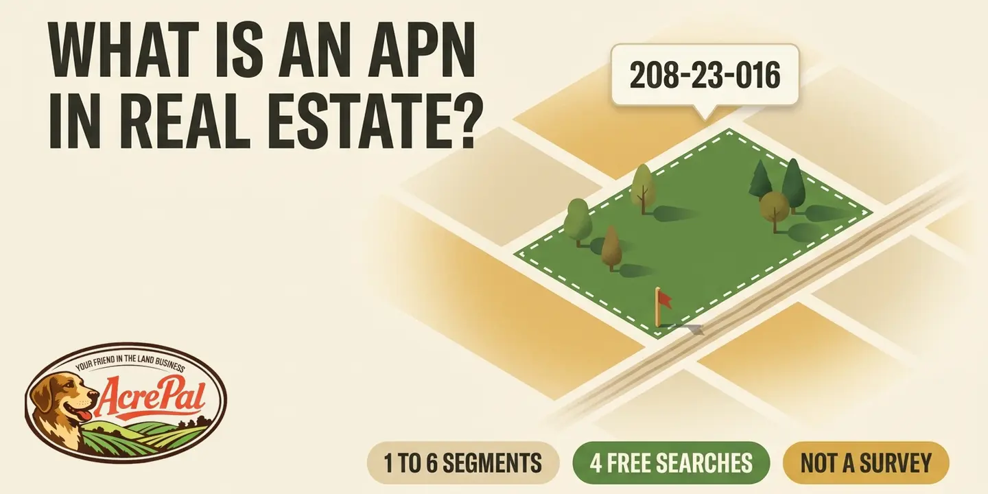
You are looking at a listing for a parcel you have never stood on, and the only thing separating it from the thousand acres around it is a string of numbers. So what is APN in real estate, and how far does that number actually get you?
APN stands for Assessor's Parcel Number. It is the identifier a county assessor assigns to a piece of ground so the county can put it on the tax roll and bill somebody for it.
Most pages on this topic collapse the next two sentences into one idea. The parcel number tells you which piece of ground. The legal description tells you what that piece of ground is. A buyer who treats those as the same job can lose money in either direction, by trusting an address instead of the number, or by trusting the number to draw the boundaries.
Everything below is checkable for free on county websites, by someone who does not own the property yet and has no deed and no tax bill to work from.
What an APN Actually Is, and Who Hands It Out
The county did not create this number for your benefit. It created it to collect taxes, which explains nearly everything else about how the number behaves.
A county assessor assigns the parcel number so the piece of ground can be tracked on the tax roll. Landmodo puts it as plainly as anyone, calling the APN an administrative identifier the county assessor uses for tax and record keeping, then adding that it is "a number, nothing more." Keep that phrase close, because people load this number with weight it was never built to carry.
The number belongs to the parcel, not to the person. A sale by itself does not change it, so one number can follow a parcel through three owners. It does change when the parcel changes. The Placer County assessor in California lists three triggers, a map book page reconfigured so the parcel moves to a different page, a change in the parcel's own configuration that voids the old number and issues new ones, and a map page filling up, which forces a renumber of every parcel on it.
The same number goes by other names. AIN, PIN, PID, tax account number, property account number and Sidwell number all point at the same thing, and which one you see depends on the county.
People use the number to pull the tax record, open the county GIS map, search recorded documents, and get a real quote on what it costs to run utilities to a parcel rather than trusting a listing that says power is nearby. Utility providers want the parcel number, not a listing's word for where the poles stop.
That is the whole job description, and it is narrower than most people assume.
Identify the Land by Its Parcel Number, Never by the Street Address
James Hoffman bid at a Mecklenburg County, North Carolina tax foreclosure on what he believed was a house on Rozzelles Ferry Road in Charlotte. "I said, 'Oh man, this is a great deal,'" he recalled.
What he actually bought was the vacant landlocked lot next door, with no street access at all.
The mechanism is ordinary, which is what makes it frightening. County records updated the parcel's street address while the foreclosure was already in process. Meanwhile the firm running the sale kept using the original address for legal consistency. Between the two adjacent parcels, the ID numbers differed only in the last two digits.
Hoffman was out more than $73,000. He granted that "it's on the buyer to do their own due diligence," then pushed back hard on where that burden had landed, arguing the law firm running the sale should have done what was right. "Who can you trust?" he asked.
The county's law firm put the lesson in writing afterward.
"Because street addresses are subject to frequent change, it is critical when researching a particular parcel to rely on the Parcel Identification Number, which remains consistently affiliated with the parcel, as opposed to the street address."
Vacant land is where this bites hardest. Plenty of raw acreage has no street address at all, so the parcel number is not the better handle, it is the only handle. Cochise County, Arizona says vacant land generally gets no street address unless a utility or a government use needs one, and that the county issues an address automatically once someone pulls a building permit for a habitable home or an active business.
For a 911 call on address free land, the county tells you to be ready to give GPS coordinates instead. An address that will not bring an ambulance is not an address you should be buying land by.
When you are looking at land in a county you have never visited, that gap is the whole risk. Open every county phone call with the parcel number rather than the address.
Search by the number. Confirm by the number. Sign by the number.
The APN Does Not Tell You Where the Property Lines Are
A major national real estate portal that ranks on page one for this exact question lists, among the things an APN does, "Define property lines." The Sacramento County Assessor says the opposite in its own FAQ. "Assessor Maps are NOT surveys and as such should not be used in either defining property lines or in resolving disputes between neighbors."
Same four words. Opposite instructions.
Snohomish County, Washington points its readers somewhere else entirely, saying "accurate property ownership boundaries can be determined by a licensed professional land surveyor."
A California appellate court settled this in 2022, and the facts are almost too on the nose. In XPO Logistics Freight, Inc. v. Hayward Property, LLC, a recorded parcel map had divided a Hayward property into four parcels, later reconfigured into two. The assessor had separately carved the same dirt into three assessor's parcels with their own APNs, on an unrecorded map.
Two pictures of the same land, one legal and one for tax, and then a lawsuit over the strip in between.
The court held that APNs "are created for use by the assessor in assessing property taxes; they are not relevant to issues concerning the alienation of real property." Alienation of real property means the legal transfer of ownership. In plain English, the parcel number is a tax bookkeeping label, and when it disagrees with the legal description, the legal description wins.
The court also quoted Cafferkey v. City and County of San Francisco, where property described by its APN "need not correspond with actual subdivisions, lots, tracts or other legal divisions or boundaries of land."
That is California law, decided under California Revenue and Taxation Code sections 327 and 11911.1, and it does not bind Ohio or Florida. It still matters outside California because the underlying mechanic is the same everywhere. Assessors index land so it can be taxed. Deeds convey land by legal description.
Only one of those two systems defines what you are buying, and the difference between what a deed does and what title means runs on the same logic.
Plenty of pages get this right. BatchData assigns boundary definition to the legal description rather than the parcel number, and Landmodo does the same. The correct answer and the dangerous answer sit side by side on the same results page, both written with confidence, and nothing there tells a buyer which is which.
So keep the two jobs separate. The parcel number answers which piece of ground, the legal description answers what it is.
Three Number Sets Is a Convention, Not a Rule
Two pages on this search present a fixed shape as the standard, and one of them states flat out that standard APNs always have three number sets. One of the six counties we sell land in has zero.
AcrePal buys and sells rural land in six counties across five states. These are the formats we type into those counties' portals.
- Mohave County, Arizona, three sets, 208-23-016
- Apache County, Arizona, three sets, 201-28-061, and the undashed 20128061 also works
- Elko County, Nevada, three sets, 011-003-099
- Modoc County, California, three sets, 041-242-11
- Costilla County, Colorado, one flat run of eight digits with no dashes anywhere, 70113650
- Putnam County, Florida, six segments, 37-13-27-7063-1180-0340, and the county calls it a PID rather than an APN
Four of the six do have three sets, so the convention is real. It is just not a rule. A buyer who treats it as one will look at a Costilla number, decide they must have mistyped something, and start hunting for dashes that were never there.
Neither counterexample rests on our word alone. Putnam County's own public GIS server returns parcel IDs in that same six segment shape, including 13-09-26-5965-0000-0440. An independent Colorado parcel index returns Costilla identifiers that are uniformly eight digits with no separators, including 40001721 and 70805450.
Costilla adds a second wrinkle. Its search field is labeled Account Number, so the term APN does not appear anywhere in that county's interface. Search for an APN field there and you will not find one.
Widen the lens past those six and the naming gets stranger. New York outside New York City uses an SBL number, for section, block and lot, assigned by the local town or city assessor. Louisiana has parishes instead of counties, and a parish builds its parcel identification number from a map number, a block number and a centroid number. Texas appraisal districts commonly list a Property ID, a Geographic ID and an APN as three separate identifiers on the same tax card, and appraisers themselves mix them up.
Copy the number exactly the way the county writes it, dashes and all, or no dashes at all.
When the County's Own Website Rejects the Right Number
You type the number exactly as it appears on the document, hit search, and the county returns nothing. The obvious conclusion is that the number is wrong, or the listing is fake. Often neither is true.
Start with Apache County, Arizona. Its EagleWeb assessor portal accepts the dashed form 201-28-061 or the undashed form 20128061. What it does not accept is the county's own internal 01-XX-XX-XXXX database format. A buyer holding a document that carries the internal version will search the official county site, get zero results, and reasonably conclude the parcel does not exist.
Modoc County, California does something similar and takes a popular claim down with it. The Modoc assessor shows a three segment APN, 041-242-11. The county tax portal wants a four segment form with a trailing 000, something like 036-274-005-000, before it will pull the bill. Same parcel, two county systems, two required shapes.
One page on this search says a fourth number set marks a condo, a duplex or an apartment. In Modoc County the fourth segment is required for plain vacant rural acreage with nothing built on it, purely because a different county system wants it that way. If you are buying land in Arizona or anywhere else with two separate portals, assume the formats will not match until you have checked.
When a search comes back empty, work through this before you panic.
- Try the number with the dashes, then again without them
- Search by owner name, or by section, township and range, instead of by number
- Check whether the assessor and the treasurer are two different systems with two different formats, because they usually are
- Call the assessor's office and read the number off the document, which is a two minute call
How to Check an APN When You Do Not Own the Property Yet
Four county websites will tell you most of what you need, and none of them will ask whether you own the place.
The most common advice on this search is to find the number on your property tax bill, on your deed of trust, or by asking your real estate agent. Every one of those assumes you already own the property or are being represented in a financed deal. The person typing this question into Google usually owns none of it yet.
The Assessor or Tax Records Search
Confirms the tax parcel identity, the assessed owner name, the mailing address, the tax classification, the acreage the assessor carries, and improvement records where structures exist. It will not confirm clear title, absence of liens, or survey accuracy. The assessed value on that page is a tax figure produced by a formula, not what the land is actually worth.
The County GIS or Parcel Viewer
Confirms parcel shape, the parcel number, approximate acreage, neighboring context, road frontage and terrain. What it cannot give you is legal boundaries, legal access or buildability, for the reason the assessor already stated, these maps are not surveys. Counties also publish a final parcel edition once a year after the tax roll date, and the preliminary editions released in between can carry inconsistencies.
The Recorder or Clerk Document Search
Confirms deeds, plats, easements, covenants, restrictions and road maintenance agreements. It cannot confirm clear title, absence of encumbrances, or the legal meaning of anything you read there. This is the one that lets you hold the legal description up against the parcel number.
The Treasurer or Tax Collector Portal
Confirms tax account status and payment history by parcel number. It cannot confirm that a lien has actually been released, only what the county ledger currently shows as paid or owing.
Run them in this order.
- Pull the parcel on the assessor site by number, then check the acreage and owner name against the listing
- Pull the same number on GIS and look at the shape, the road frontage and the neighbors
- Pull the most recent recorded deed and read the legal description, then confirm it describes the same ground the map is showing you
One honest limit. None of this is a title search and none of it is a survey. It tells you that you are looking at the right parcel. It does not tell you the title is clean.
That is the ceiling on a free hour of county searching.
Back Taxes Stay With the Dirt, and the APN Is How You Find Them
A property tax lien attaches to the parcel, not to the person who ran up the bill. Buy the parcel and you have bought the arrears. Checking for that takes one search and costs nothing.
Colorado says it in language that leaves no wiggle room. Under C.R.S. 39-1-107, taxes levied on real and personal property "shall be a perpetual lien thereon, and such lien shall have priority over all other liens until such taxes, delinquent interest, advertising costs, and fees shall have been paid in full." Thereon means on the land. Perpetual means it waits.
Arizona is shorter and just as blunt. A.R.S. 42-17153 says "a tax that is levied on real or personal property is a lien on the assessed property." The statute puts that lien ahead of every other lien and encumbrance, with two exceptions, liens held by the state itself and liens for property taxes from other years. Read that exception list again, because it proves the point.
The only things that outrank a property tax lien are the state and more property tax.
That is two states, and we sell in both, so if you are shopping for land for sale in Colorado, that first statute is sitting underneath your deal. The mechanic is common across the country, but statutes differ, so look up your own state's before you assume.
The practical step is small. Take the parcel number to the county treasurer or tax collector, which is usually a different website from the assessor, and pull the payment history before you sign anything. Delinquent years showing on that screen are a question for the seller and for the closing agent, not something to sort out after the deed records.
Unpaid taxes are not the only obligation that rides along. County code enforcement cleanup costs can attach to the parcel as a lien too, and they do not always show up in the public record.
The seller's unpaid taxes do not stay with the seller.
One Parcel Is Not the Same as One Lot
You are buying one parcel number. How many lots is that?
A parcel is an assessment unit, an identification created for taxation purposes. A lot is a recognized subdivision with its own legal description and its own development rules. Most of the time they line up. When they do not, the gap costs money.
Wikipedia states it plainly. One parcel may encompass multiple lots. Another page on this search labels the third segment of an APN the lot number, which is where the confusion gets planted.
A Putnam County, Florida parcel ID in our own files makes it concrete. 05-10-24-9045-0090-0430 covers Trout Lake Village Block 9, Lots 43 and 44. Two platted lots, one parcel ID, one tax bill, one line on the assessment roll. Nothing about the number itself tells you there are two.
So saying you are buying APN X does not by itself tell you whether you can later sell half of it. That answer lives in the legal description and in the county's subdivision rules, and splitting a parcel into separate lots is its own process with its own approvals.
It runs the other way too. One property can carry two parcel numbers. Placer County, California explains that a state established tax rate line can split a property into two numbers, and so can a road, a water feature, or a parcel that spans two assessor map pages. The county will only combine them under certain size and value thresholds, so plenty of owners simply live with two bills.
Before you assume you can sell half of it, find out how many lots the legal description actually names.
FAQ
What does APN stand for in real estate?
Assessor's Parcel Number. A county assessor assigns it to a specific piece of ground so that parcel can be tracked on the tax roll and billed each year. It identifies the parcel rather than the owner, which is why a sale by itself does not change the number. Splits, merges and assessor map reconfigurations do change it.
Is an APN the same thing as a parcel number, a PID, or a tax ID?
Usually yes. Counties use different names for the same identifier, including AIN, PIN, PID, parcel number, tax account number, property account number and Sidwell number. Costilla County in Colorado labels its search field Account Number, and Putnam County in Florida calls the identifier a PID. Same job, different label, and the label depends on where the land sits.
How do I find the APN for a property I do not own?
Search the county assessor's website by street address or owner name, or open the county GIS parcel viewer and click the parcel. Both are free, and neither asks whether you own anything. The tax bill and deed methods most pages recommend only work if you already own the property, which is the wrong assumption for most people asking.
Does the APN change when a property is sold?
No. The number belongs to the parcel rather than to the owner, so a sale on its own leaves it alone. It changes when the parcel itself changes, on a split, a merge, or a reconfiguration of the assessor's map book page. Placer County in California documents all three of those triggers.
Can I use the APN to find the property boundaries?
No, and the assessors who assign the numbers say so themselves. The Sacramento County Assessor states that assessor maps are not surveys and should not be used in defining property lines or resolving disputes between neighbors. Boundaries come from the recorded legal description, and where real money is on the line, from a licensed surveyor.
What is zoning in real estate, and does the APN tell me the zoning?
Zoning is the local rule set that governs what you may legally build and do on a parcel, and no, the APN does not tell you the zoning. The number is only how the county finds the record. Use it to look up a zoning classification or to ask the county directly.
What should I do if the APN on the listing does not match the county record?
Stop and resolve it before you sign anything. Try the number with the dashes and then without them, search the assessor site by owner name or by section, township and range, then call the assessor and read the number off the document. A formatting mismatch is common. A real mismatch means the listing may not describe the parcel you think it does.
Can one purchase include more than one APN?
Yes, and it is common on rural land. A tax rate line, a road, a waterway, or a parcel that spans two assessor map pages can leave one property carrying two parcel numbers and two tax bills. Confirm every number listed in the purchase agreement separately instead of assuming one deal equals one parcel.