
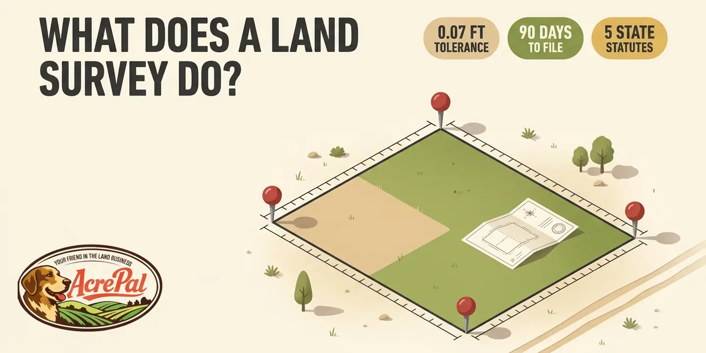
You have three tabs open. The listing says 5 acres, the county GIS viewer draws a red outline around the parcel, and somewhere on your desktop is a plat the seller sent. None of those three things is a land survey.
A land survey is a licensed professional's legal opinion of where your boundary runs, built from evidence they gathered on the ground and signed their name to. The listing acreage is an estimate. The county map is a reference. The old plat shows how the land was divided on paper, decades ago.
All three are useful. None is that opinion. So what does a land survey do that they cannot? The national standard for land title surveys answers in its own opening line.
Purpose - Members of the American Land Title Association® (ALTA) have specific needs, unique to title insurance matters, when asked to insure title to land without exception as to the many matters which might be discoverable from survey and inspection, and which are not evidenced by the public records.
A survey exists to find what the public records do not show.
We sell rural land, so we went and read the licensing statutes in the five states where we sell, and the disclaimers the counties publish on their own map viewers. The section numbers are below. So is the part almost nobody writes down, which is what a survey cannot do for you.
What a Land Survey Actually Does
What separates a licensed surveyor's number from yours, taken with a tape and a phone? Not precision. The statutes draw the line elsewhere.
Arizona, our largest market, defines the professional at A.R.S. 32-101(B)(23).
23. "Land surveyor" means a person who by reason of knowledge of the mathematical and physical sciences, principles of land surveying and evidence gathering acquired by professional education or practical experience, or both, is qualified to practice land surveying as attested by registration as a land surveyor.
Two words carry the whole idea. Evidence gathering. The license is not for measuring accurately, it is for judging what the measurements mean.
Florida does the same at Fla. Stat. 472.005(4)(a).
(4)(a) "Practice of surveying and mapping" means, among other things, any professional service or work, the adequate performance of which involves the application of special knowledge of the principles of mathematics, the related physical and applied sciences, and the relevant requirements of law for adequate evidence ...
Boundaries, says ALTA/NSPS Section 3.D, "...must be established and/or retraced in accordance with appropriate boundary law principles governed by the set of facts and evidence found in the course of performing the research and fieldwork."
Three authorities, three vocabularies, one idea. The conclusion is an opinion a licensed professional signs.
Arizona's list of the work opens at A.R.S. 32-101(B)(22).
(a) Measuring land to determine the position of any monument or reference point that marks a property line, boundary or corner for the purpose of determining the area or description of the land. (b) Locating, relocating, establishing, reestablishing, setting, resetting or replacing of corner monuments or reference points that identify land boundaries, rights-of-way or easements.
Paragraph (a) is finding your corners. Paragraph (b) is putting a monument back where the evidence says a corner belongs, or setting one where none survives. A survey also states its uncertainty instead of claiming perfection, since ALTA/NSPS sets positional accuracy at the 95 percent confidence level.
Why a County GIS Parcel Map Is Not Your Property Line
Across the seven pages ranking for this question, not one mentions that a county GIS viewer is not a survey. We do not have to argue it. The counties argue it for us.
Mohave County, Arizona is our largest market, so this is the map our own buyers use. The county publishes this on its GIS page, in its own capital letters.
THE VIEWER IS NOT TO BE USED FOR NAVIGATION, PROPERTY DESCRIPTIONS, OR DETERMINATION OF LEGAL TITLE.
The same page calls that data a compilation of surveys, deeds, county resolutions and aerial photography, then says what it is not.
It should be interpreted as the best available compilation, but SHOULD NEVER BE SUBSTITUTED FOR SURVEY OR DEED INFORMATION.
One more line settles it in nine words. "Property descriptions must be obtained from surveys or deeds."
Putnam County, our Florida market, says it in a quieter register.
This information is provided as a visual representation only and is not to be used as a legal or official representation of legal boundaries.
Before that map will open, you have to click I Accept. A Florida buyer agrees in advance that what they are about to look at is not a legal representation of boundaries.
Two counties in two states, both read off the counties' own pages. That is the whole sample we checked.
The governing standard also puts a number on how close a real survey has to be.
The maximum allowable Relative Positional Precision for an ALTA/NSPS Land Title Survey is 2 cm (0.07 feet) plus 50 parts per million (based on the direct distance between the two corners being tested).
Against that, one homeowner filmed an informal comparison of the onX Hunt app against the real survey stakes on their own property. Two of the four corners came out essentially on the mark. One was off by 14 inches. One was off by more than 212 inches, about 17.7 feet.
One property, one afternoon, not a study, and still the closest thing to a side-by-side we found.
None of this makes the county map useless. It is good for finding a parcel from the road, checking a listing, and seeing which assessor record goes with which piece of ground, which is where an APN in real estate comes in. What it is not is a boundary.
The Listing Acreage, the Old Plat, and the Certificate That Is Not a Survey
Three pieces of paper get mistaken for a survey. The third is the interesting one, because a licensed land surveyor may well have prepared it.
Start with the acreage. That number usually traces back to an assessor record or to a description written when the parcel was first carved out, and deeds routinely carry the phrase *more or less* after the acreage for exactly that reason. Everyone in the chain understands it as approximate. A survey can move it, and usable acreage is one of the things that moves what a parcel is worth, which we get into in how much your land is worth.
Then the old plat. A recorded subdivision or county plat map shows how land was divided on paper at the moment it was divided, which is a different job from finding your corners today.
Colorado is where this gets sharp. Under C.R.S. 38-51-108(1), a professional land surveyor may prepare an improvement location certificate for one specific client based on the surveyor's "general knowledge of land boundaries and monuments in a given area".
It looks like a survey. A surveyor drew it. And the statute makes the document confess, in words the legislature wrote, that it is not one.
I hereby certify that this improvement location certificate was prepared for .... (individual or firm) ...., that it is not a land survey plat or improvement survey plat, and that it is not to be relied upon for the establishment of fence, building, or other future improvement lines.
Each run of four dots is a blank in the statute itself, waiting to be filled in. The same section requires the certificate to be "prominently labeled" and says it "shall not be designated as or construed as being a land survey plat or improvement survey plat."
Colorado did not settle for warning buyers about a cheaper lookalike. It wrote the confession into the statute and made the paper carry it. If someone hands you one of these and you believe you are holding a survey, the document in your hand disagrees with you. Costilla County is one of our markets, so this is not an imported example.
How to Read a Plat of Survey
Your plat arrives as a PDF and most of it looks like code. It is not. Two statutes set the anatomy, starting with A.R.S. 33-105(C).
1. All monuments found, set, removed, reset or replaced, the kind, size and location of such monuments ... 2. Bearing and basis of bearings and length of lines to the nearest one one-hundredth of a foot ... 3. Dates of survey, scale of map and north arrow or other means of orientation.
Nevada requires the same at NRS 625.350(2), down to "the basis of bearings, bearing and length of lines." Read yours in order.
North arrow and scale. Orient the page, then check the survey date, which dates the evidence.
Monuments. A survey monument is the object in the ground marking a corner. Found means a previous surveyor's marker was located, set means this surveyor placed one.
The legend translates the rest. IRF is iron rod found, IRS iron rod set, IP iron pipe, CMF concrete monument found, RB rebar. Leave them alone. Under NRS 625.550, intentionally removing or defacing a properly established monument in Nevada is a public offense "in no event less than a misdemeanor."
Bearings, distances and the basis of bearing. A bearing is a compass direction for one boundary line, and the distance is that line's length. The basis of bearing is the reference the whole drawing is rotated to. An old description in chains is no red flag, since A.R.S. 33-105(C) allows "chains, varas or other units of measurement as implemented by older surveys." R or REC beside M is prior record versus this surveyor's measurement, and a good plat shows both when they disagree.
Easements. Rights of way appear as dashed lines, and whether one exists is the difference between access and a landlocked property.
The seal. NRS 625.560 makes it unlawful "to sign or stamp any map, plat, report, description or other document pertaining to the practice of land surveying" without "an unsuspended and unrevoked license as a professional land surveyor." The seal is a person putting their license behind an opinion.
Either way the surveyor is retracing an original description on the ground, whether that description walks the perimeter by direction and distance, called metes and bounds, or fixes the parcel by its place in the rectangular grid.
Corners go missing, and no competing page says what happens then. A.R.S. 33-106(B)(4) requires the corner record to set out the procedure followed "by sketch and narration, in reestablishing the corner reported if no acceptable evidence of the original monument or its location can be found," on a thirty-day clock, not the ninety days in 33-105. Colorado requires a monument record to "describe at least two accessories or reference points," so the corner can be rebuilt from nearby evidence after the marker is gone.
Types of Land Surveys and What Each One Answers
Five of the seven competing pages open with a list of survey types, one of them running to twelve, which leaves you no better able to choose. Almost every rural buyer under contract needs a single product, a boundary survey. Treat the table as reference rather than homework.
| Survey type | The question it answers | Does a rural land buyer usually need it? |
|---|---|---|
| Boundary survey | Where exactly does my land end, and where are the corners on the ground? | Usually yes |
| ALTA/NSPS land title survey | What does a title company or lender need to insure title without a survey exception? | Rarely on a cash rural buy, common on lender and commercial deals |
| Topographic survey | What shape is the ground, and where does water run? | Only if you are siting a build or a septic system |
| Subdivision survey | Can this parcel legally be split into smaller ones? | Only if you plan to divide |
| Construction or stakeout survey | Where exactly do the structure, the well and the driveway go? | Later, not before closing |
| Improvement location certificate (Colorado) | Roughly where do the improvements sit, for one named client? | No, and the section above explains why |
One terminology note. The current Minimum Standard Detail Requirements for ALTA/NSPS Land Title Surveys took effect February 23, 2021. The name changed from ALTA/ACSM to ALTA/NSPS at the 2016 revision, because NSPS is the successor organization to the American Congress on Surveying and Mapping. SafetyCulture's page still calls the product an "ALTA/ACSM Survey," a label out of date since that revision.
Apex Survey, by contrast, runs the best page on this search result, with current terminology, the widest cost table, and a scope honestly limited to Florida, one of our markets. LAN Associates is the only page that both expands ALTA/NSPS correctly and uses the word monuments.
What a Land Survey Does Not Do
Every page ranking for this question is written to get you to order a survey, so none of them tells you where the document stops. It stops in four places.
A survey does not convey or prove ownership. It locates a boundary that some document describes. It does not tell you the document is good, that the seller owns what they are selling, or that no lien rides along. A title search and title insurance do that, and we cover the split in deed vs title.
Rocket Mortgage and Carroll Engineering both describe a mortgage survey as verifying title ownership. A surveyor does not verify ownership. Unless somebody runs a title search, nobody has checked whether the seller owns what they are selling.
A survey does not determine zoning. Carroll Engineering's page lists "Zoning: Determines land zoning category" among the things a survey does. A survey may plot a setback or note a district, but the county or municipality sets zoning, not the surveyor. Zoning is its own due diligence, and we walk that sequence in what an R-2 zone is.
A survey does not end a boundary dispute by itself. It is a professional opinion, and two licensed professionals working from different evidence can reach different conclusions. One homeowner posted an account of exactly that, having hired a surveyor before building a fence while the neighbor hired another, and both surveyors held they were right. One social media account is not data, but the mechanism is real.
A survey does not make land buildable. It does not guarantee the county will accept the acreage, it says nothing about septic, water or power, and it does not confirm legal access. Those are separate questions, and if you are pricing them, start with what it costs to get utilities on land.
A survey does pull weight in one place, title insurance. Standard policies carve out coverage for boundary problems a current survey would have revealed, which is called the survey exception, and providing one is how a buyer gets that exception narrowed or removed.
What a Land Survey Costs, and Why the Published Prices Do Not Agree
Three of the highest-ranking pages on this exact question quote three different prices for a plain boundary survey, and not one of them acknowledges that the others exist.
| Source | Published boundary survey range |
|---|---|
| Millman Land | $450 to $600 |
| Apex Survey | $400 to $1,500 |
| Rocket Mortgage | $1,200 to $5,500 |
Millman Land's ceiling is half of Rocket Mortgage's floor. These are not three products described at three price points. They are the same product priced an order of magnitude apart, and averaging them would produce a number that is wrong in both directions.
Rocket Mortgage earns real credit here as the only page in the set that says where its numbers come from. "This price, and all others mentioned in the article, come from Angi, which has an in-depth methodology to determine average costs." That disclosure is worth more than the figures it discloses. Angi is a home services marketplace rather than a surveyor or a professional body, though, so what is being reported is marketplace data and not a surveyor's rate.
Rocket also writes that "a plot of 40 acres will likely send you into the five-digit zone." Treat that as conditional. TheLandGeek, itself a content marketing site rather than a surveying firm, puts a 40 acre rural boundary survey anywhere from roughly $3,000 to $15,000 depending on terrain and prior survey history. Five figures happens. Often it does not.
Our own finding is worth stating plainly. We went looking for a surveyor's published rate sheet or a state surveying society fee schedule for rural acreage and found neither, because every figure we could trace ran back to an aggregator. So call two or three licensed surveyors in the county the parcel sits in and ask for a quote on that parcel, since terrain, brush, access and prior survey history are what actually move the price.
Do You Need a Survey Before You Close, and Does One Already Exist
Before you pay for a new survey, find out whether somebody already paid for one. Arizona's A.R.S. 33-105(A) says a land surveyor "shall file a record of a land survey not later than ninety days after its completion with the county recorder," but only when the survey discloses a material discrepancy or evidence that "might result in alternate positions of lines or points." Nevada runs the same 90 day clock and trigger at NRS 625.340. California draws the line in the text at Bus. & Prof. Code 8762, where a surveyor "may file with the county surveyor" but "shall file" on material evidence or a material discrepancy.
We owe a correction. We expected some states to compel filing and others not to, and that is not what the statutes say. All three impose a conditional duty on a 90 day clock.
So a survey of your parcel may be on file, may have been done and never filed because it turned up nothing new, or may never have been done. Go look.
Start at the county recorder in Arizona and Nevada, the county surveyor in California, or the assessor. It is also worth calling whoever's name is on an old plat or a monument cap, since a surveying firm's own files can hold work that never had to be filed anywhere public.
Does an old survey still count? Chase says land surveys "don't expire." Carroll Engineering says surveys "older than 10 years may warrant updating" without sourcing the ten. A survey goes stale when the ground changes, not on a schedule. And one certified to a previous owner was written for their closing, so your name will not appear anywhere on it.
A lender or title insurer usually forces the decision. A cash buyer gets to make it. If you plan to fence, build, run a driveway or sell a piece later, or if a structure or road already sits near a line, get the survey. If you are buying unimproved acreage to camp on and the corners are already monumented, skipping it is a judgment call.
Cardinal Surveying filmed the other outcome, a neighbor who took an overhead utility line for the boundary and planted a garden 33 feet onto the owner's land.
Frequently Asked Questions About Land Surveys
What is a land survey in simple terms?
The plain land survey definition is a licensed professional's evidence-based opinion of where your boundary runs, marked on the ground with monuments and drawn on a signed, sealed map. Arizona's statute defines the surveyor by evidence gathering rather than by measuring, which is the whole difference between a survey and what you could do yourself with a tape.
How do I read a survey plat?
Start with the north arrow and the scale so the page is oriented. Follow the bearings and distances around the perimeter next, since those trace the shape of the parcel. Then read the monument symbols against the legend to see which corners were found and which were set. Finish at the seal, and check who the survey was certified to.
What are the main types of land surveys?
Most land buyers need a boundary survey, which locates the corners and the property line. An ALTA/NSPS land title survey is the lender and title company version. A topographic survey maps the shape of the ground. A subdivision survey covers splitting a parcel, and a construction survey stakes out where things actually get built.
Can I survey my own land?
No, not in any way that carries legal weight, because state statutes reserve the practice of land surveying to registered professionals. Millman Land puts it well in saying a self-survey is permitted for personal records only and not for legal purposes. Walking your lines with your plat, a tape and a metal detector to find existing pins is fine and worth doing. It just is not a survey.
Is a county GIS map or a parcel app close enough?
No. Mohave County's own viewer says its data should never be substituted for survey or deed information, and Putnam County's makes you accept that it is not a legal representation of legal boundaries before the map will open. We sell land in both. Use those maps to find a parcel and check a listing, not to place a fence.
Do I need a survey to buy vacant land with cash?
No law requires one for a cash purchase, though a lender or title insurer usually will. Whether it is worth paying for comes down to whether you plan to build, fence or divide, and whether anything already sits near a line. We tell buyers straight what is and is not established about a parcel's boundary before they commit, and you can see what we have listed at acrepal.com.